
May’s walk of the month: Bardon Mill to Haydon Bridge
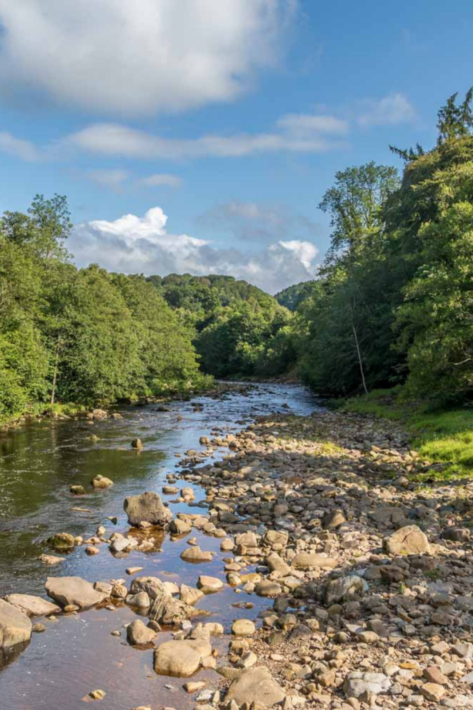
Is that summertime we can spot on the horizon? Longer, warmer days can only mean one thing – more adventures to be had!
Distance: 14.5km (9 miles)
Elevation: 373m
Time: 3.5 – 5 hours
HLN Top Tip: This one-way walking route isn’t a circular, but the start and end points are conveniently located at railway stations to allow for easy transportation between the two.
GETTING THERE
The trailhead for the Bardon Mill to Haydon Bridge Walk can be found at the Bardon Mill railway station.

THE WALK
We’re starting to see the first real rays of proper sunshine; lawnmowers are being dusted off, loungers are creaking back into action and beer gardens are back to being forever on our minds. Yep, summertime is almost upon us – and with the new season brings a whole host of adventuring opportunities.
Because, after all, longer, warmer days means you can plan for further, more exotic explorations – which is why we’ve handpicked this particular walking route as our illustrious Walk of the Month for May.
The Bardon Mill to Haydon Bridge Walk is a fantastic adventure in Northumberland that features a variety of terrain and beautifully scenic views. It’s also pretty long. Five hours hiking is no mean feat – but we promise you, it’ll more than make up for your efforts with a wealth of historical sites, fascinating forest routes, relaxing riverside vibes and views for days.

On this trail, you’ll amble along the River South Tyne and pass through the Allen Banks and Staward Gorge National Trust site, before traversing the open countryside on the way into Haydon Mill. And our particular highlight? Staward Peel.
Although there was likely a shrine existing on the site from a much earlier period (possibly even dating back to the Roman occupation), the origins of Staward Peel can officially be dated back to 1316, when a timber pele tower was constructed on site by Anthony de Lucy for use as a garrison. After the lands were annexed by Edward II in 1326, the defensive importance of the site was recognised and a stone castle was constructed. The fortification would change ownership several times over the following centuries, until it eventually fell into ruin. Although the structure was demolished in 1856, the romantic ruins of the gatehouse walls and the whispers of days long past remain.
As the Bardon Mill to Haydon Bridge Walk features a variety of terrain that includes open fields and woodlands, you will want to wear proper walking boots with good support. There are also several sections of uphill walking on this route, so be sure to bring plenty of water to stay hydrated.

THE ROUTE
Where to park: There’s no official car park at the station, but there is plenty of parking space on Station Road (NE47 7HY) leading up to the station. Please remember this is a one-way trail – so if you are taking one car, you will have to double-back on this suggested route and double your distance travelled.
If you’re taking two cars and planning on parking at the beginning and the end, parking at your finishing point – Haydon Bride railway station – is available in the station car park, as well as neighbouring on-street parking spaces.
Where to begin: Bardon Mill railway station.
Where to walk: From Bardon Mill railway station, head south and cross over the banks of the River South Tyne, turning left along the road and following it south-east for 1km.
Here, you will turn left and pass by St Cuthbert’s Church, heading north-east across the fields and forest to arrive at the edge of the road.
Following the road south, you’ll make a left onto a footpath and follow it east for 0.5km, where you will descend into the forests of Allen Banks.

After meeting up with the River Allen, follow it south for 1.5km, where you will cross the bridge over the river to continue south along the opposite bank.
After another 2.5km, you’ll pass by the medieval fortification of Staward Peel and begin climbing uphill to arrive at a four-way junction on the edge of the forest.
Turning left, continue through the forest for a short distance, before making a sharp right to exit the tree cover.
Here, cross over Harsondale Burn and climb uphill to the north-east to begin traversing the open countryside that makes up the final leg of the walk. After walking along the quiet country roads to the north-east for 5.5km, you’ll come to the edge of the A69.
Continue north-east and into Haydon Bridge, following the road as it runs parallel to the River South Tyne. After turning left and crossing over the river, you will follow Church Street to the north-west until you arrive at the endpoint of the trail at the Haydon Bridge railway station.
FOR MORE INFORMATION
To find out more about this walk, or if you’re looking to be inspired with more Northumberland rambles, check out 10 Adventures’ website